Thiessen Polygon Input Dialog Box
The Thiessen Polygon Creator allows you to quickly create polygon layers for use with the LoadBuilder demand allocation module. This utility creates polygon layers that can be used as service area layers for the following LoadBuilder loading strategies:
- Billing Meter Aggregation
- Proportional Distribution By Area
- Proportional Distribution By Population
- Projection by Land Use
- Load Estimation by Population.
The Thiessen Polygon Creator dialog box consists of the following steps:
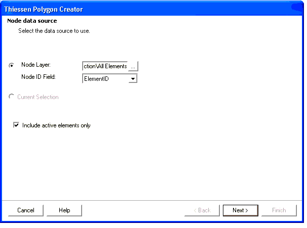
Step 1: Node Data Source
- Node Data Source—Select the data source to use.
- Node Layer—This lists the valid point feature classes and shapefiles that Thiessen Polygon Creator can use.
- Current Selection—Click if the current feature data set contains a previously created selection set.
- Include active elements only—Click to activate.
- Selection—This option allows you to create a selection on the fly for use with the Thiessen Polygon Creator. To use this option, use the ArcMap Select Features tool to select the point features that you want before opening the Thiessen Polygon Creator.
Step 2: Boundary Layer
- Buffering Percentage—This percentage value is used for calculating the boundary for a collection of points. In order to make the buffer boundary big enough to cover all the points, the boundary is enlarged based upon the value entered in this field as it relates to the percentage of the area enclosed by drawing a polygon that connects the outermost nodes of the model.
- Polygon Boundary Layer—Select the boundary polygon feature class or shapefile, if one has already been created. A boundary is specified so that the outermost polygons do not extend to infinity. For more information about boundary layers, see Creating Boundary Polygon Feature Classes .
Step 3: Output Layer
Note: The Thiessen Polygon Creator is flexible enough to generate Thiessen polygons for unusual boundary shapes, such as borders with cutouts or holes that Thiessen polygons should not be created inside. To accomplish this, the boundary polygon must be created as one complex (multi-part) polygon. For more information about creating boundary polygon feature classes, see your ArcGIS documentation.